 geocatalogue.geoportail.lu
Main>Environment, Biology and Geology>Geology
Type of resources
Available actions
Topics
Keywords
Contact for the resource
Provided by
Groups
Representation types
Update frequencies
status
Scale
-

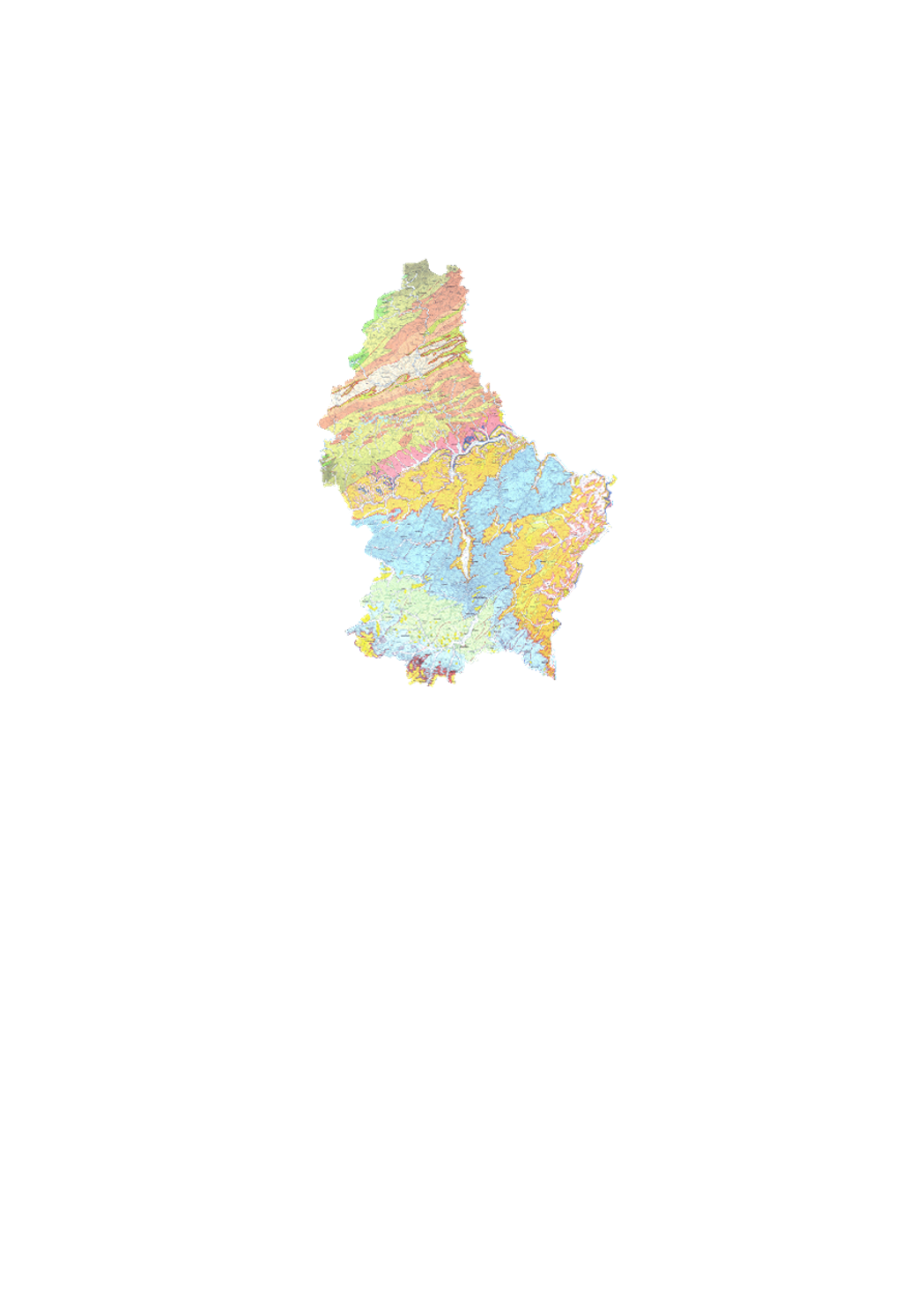
Detailed map of surface geology, in colors, with legende; on simple topographic background. "Old edition", from 1947 to 1949 by Michel Lucius. This dataset has 7 sheets at a scale of 1:25000 and 1 sheet at a scale of 1:50 000, 6 are available as originals and 2 as color copies: 1 - Ech/Alzette 1:25000 (color copy), 2 - Remich 1:25000, 3 - Luxembourg 1:25000 (color copy), 4 - Grevenmacher 1:25000, 5 - Redange 1:25000, 6 - Diekirch 1:25000, 7 - Echternach 1:25000, 8 - Wiltz 1:50000. Annotation booklets are available for some sheets: https://geologie.lu/index.php/telechargements .
-

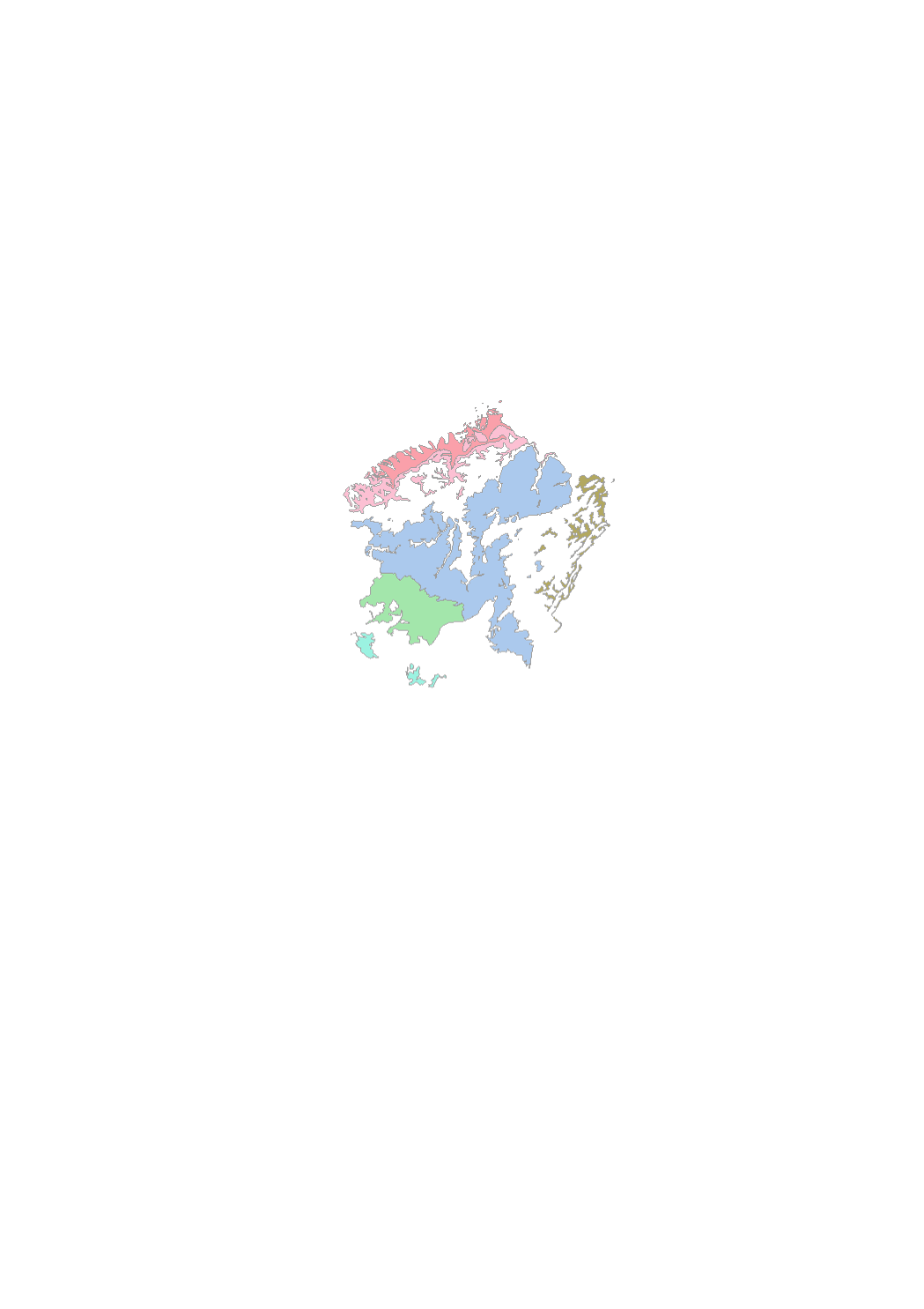
Geological overview map 1:100k 1992
-
This layer contains geological map created by the geological service of Luxembourg.
-
Detailed map of surface geology, in colors, with legende; on simple topographic background. "Old edition", from 1947 to 1949. This dataset has 7 sheets at a scale of 1:25000 and 1 sheet at a scale of 1:50 000, 6 are available as originals and 2 as color copies: 1 - Ech/Alzette 1:25000 (color copy) 2 - Remich 1:25000 3 - Luxembourg 1:25000 (color copy) 4 - Grevenmacher 1:25000 5 - Redange 1:25000 6 - Diekirch 1:25000 7 - Echternach 1:25000 8 - Wiltz 1:50000 Annotation booklets are available for some sheets.
-
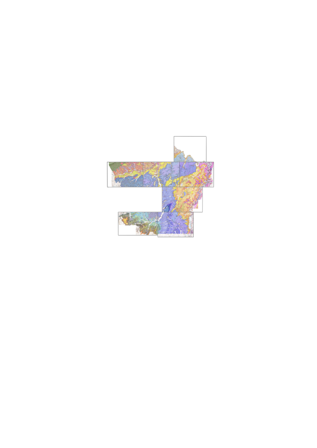
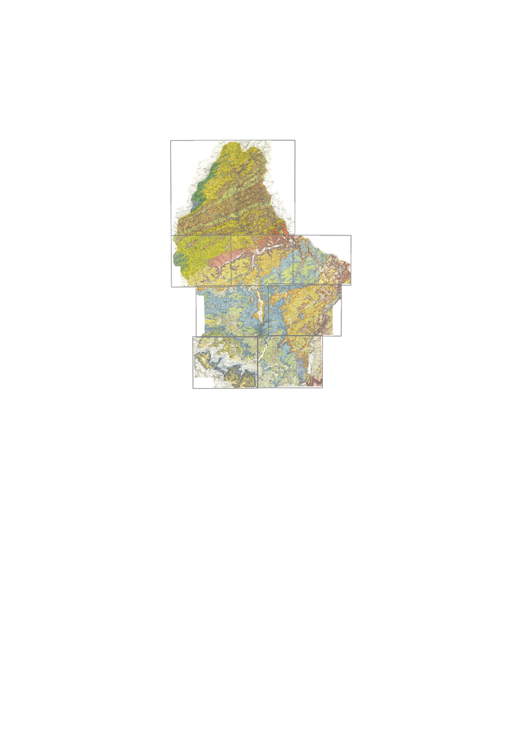
Detailed of surface geology, in 25 colors, with legend, geological cross-sections and lithologic and stratigraphic scale; on detailed topographic background with height curves. "New edition", from 1971 until today. This map set has 13 sheets at a scale of 1:25000, 7 of which are available: 6 - Beaufort 7 - Redange 8 - Mersch 9 - Echternach 11 - Grevenmacher 12 - Esch/Alzette 13 - Remich Annotation booklets available for some maps
-
Earthworks
-

Detailed of surface geology, in 25 colors, with legend, geological cross-sections and lithologic and stratigraphic scale; on detailed topographic background with height curves. "New edition", from 1971 until today. This map series has 13 sheets at a scale of 1:25000, 11 of which are available (2024): 1 - Troisvierges, 2 - Wiltz, 3 - Clervaux, 4 - Esch/Sûre, 6 - Beaufort, 7 - Redange, 8 - Mersch, - Echternach, 11 - Grevenmacher, 12 - Esch/Alzette, 13 - Remich. Annotation booklets available for some maps under https://geologie.lu/index.php/telechargements .
-
Wet underground layer of water-bearing permeable rock or loose materials.
-

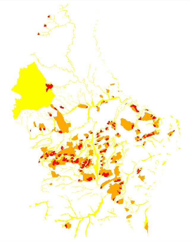
The different areas emphasize the conditions and whether or not a geothermal drilling under the criterion of the groundwater protection is permitted. Generally, drillings are approvable in the white area, approvable with depth restrictions in the orange area and approvable with more stringed conditions in the hatched area. Geothermal drillings are prohibited in the red area.
-
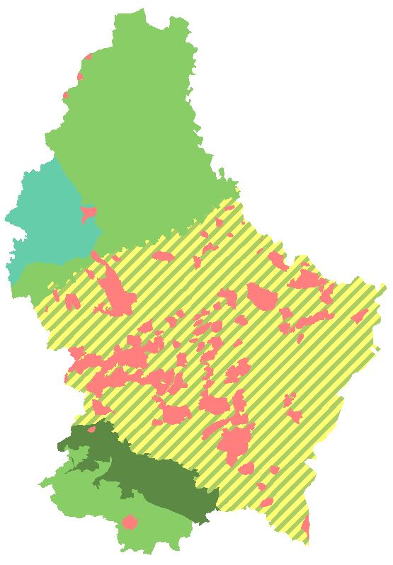
The different areas emphasize the conditions and whether or not a geothermal drilling under the criterion of the groundwater protection is permitted. To protect the groundwater, depth restrictions and the choice of heat transfer medium can be imposed. If there are questions, please contact the water management administration (forages@eau.etat.lu).